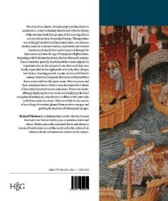
Finding their way at sea - Richard Pflederer
the story of portolan charts, the cartographers who drew them and the mariners who sailed by them

KORTE INHOUD
Beginning with their introduction in the late thirteenth century, these sometimes quaintly fanciful portolan charts enjoyed an important place in the navigator's sea chest until they were finally superceded in the eighteenth century by their cheaper but far less charming printed cousins. In the mid-fifteenth century when the Europeans first ventured beyond their home waters and into the open oceans, their successes and their sometimes-heroic failures were documented on charts of the newly discovered oceans and coasts. These new charts, although depicting ...
Details
2012Uitgever: Koninklijke Brill N.V.168 paginasTaal: EngelsISBN-10: 9061944902ISBN-13: 9789061944904Koop dit boek tweedehands
bij volgende verkopers

Original publisher's paper-covered boards, pictorial front- & backcover, large 4to: frontispiece, title-page illustration, 168pp., 100 coloured plates & illustrations, appendix, general bibliography, index, credits illustrations, acknowledgements, about the author. Goy-Houten, HES & De Graaf Publishers. 2012 [Auteur: PFLEDERER, RICHARD [TONY CAMBELL - INTROD.].] [Jaar: 2012] [Titel: Finding their Way at Sea. The Story of Portolan Charts, the Cartographers who Drew them and the Mariners who Sailed by them.]
Original publisher's paper-covered boards, pictorial front- & backcover, large 4to: frontispiece, title-page illustration, 168pp., 100 coloured plates & illustrations, appendix, general bibliography, index, credits illustrations, acknowledgements, about the author. Very fine copy - as new. Still shrink-wrapped. Goy-Houten, HES & De Graaf Publishers. 2012 [Auteur: PFLEDERER, RICHARD [TONY CAMBELL - INTROD.].] [Jaar: 2012] [Titel: Finding their Way at Sea. The Story of Portolan Charts, the Cartographers who Drew them and the Mariners who Sailed by them.]
